Wednesday 14th December 2016
TDBC full council met yesterday evening and voted to adopt the Site Allocations and Development Management Plan (SADMP) This plan approves in principle the building of development in designated areas of Taunton. One of these areas is Staplegrove so will shape the way the planning application is considered in the New Year. It does however set out a clear set of conditions that both developer and council must abide by. Clearly this will be of great assistance to those who wish to challenge the building of more houses in North Taunton where the appropriate infrastructure will not be forthcoming in the first instance. Some of these policies are listed below. You can use these to justify your challenges when making your representation on the planning application website. Short cuts to both applications can be found on this site under "Further Information"
Policy A3: Cycle network
New development should not conflict with, and where relevant should provide for:
A. On and off-road cycleways as shown on the Proposals Map;
B. Traffic calming, traffic management and junction re-design to benefit cyclists;
C. Convenient and secure cycle parking facilities;
D. Provision of lighting on paths within, and where appropriate, between urban
areas to enable cycling after dark
E. Implementation of cycle schemes identified in the County Council's Future
Transport Plan.
Justification:
1.5.7 There are good opportunities to develop a network of new and improved cycle paths,particularly in Taunton but also to some extent in Wellington. On average, around 6% of journeys to work in Taunton Deane are currently made by bike, rising to 10% in Comeytrowe.
Levels of cycling in Taunton are some of the highest of any non-university town, but are still relatively low by the standards of many countries on the Continent. There is a need for significant investment in the provision of new cycle facilities and the maintenance of existing ones.
Policy A5: Accessibility of development
Residential development should be within walking distance of, or should have
access by public transport to, employment, convenience and comparison shopping, primary and secondary education, primary and secondary health care, leisure and other essential facilities.
All major non-residential development should be accessible within walking distance or by public transport to a majority of its potential users.
Provision should also be made for cycling between residential development and
non-residential facilities, or between a non-residential development and its
catchment area, where these lie within 5km of the development.
Maximum acceptable travel time (minutes)
For public transport, includes waiting time and walking times at each end of the
journey
Maximum acceptable walking distances (i.e. not 'crow fly' distances)
Residential development in Taunton and Wellington
LEAP 400m NEAP 1000m
Bus stop 400m Playing fields 1000m
Primary school 600m Health centre 1000m
Local shops 800m Secondary school 1500m
Policy ENV1: Protection of trees, woodland, orchards and hedgerows
Development which would harm trees, woodlands, orchards, historic parklands
and hedgerows of value to the area's landscape, character or wildlife will not be
permitted. Where the loss is unavoidable, the works (or development) should be
timed to avoid disturbance to species that are protected by law. Adequate provision must be made to compensate for this loss.
The proper management of this resource for nature conservation purposes will
be sought.
Justification:
1.7.1 The Framework emphasises that planning policies should aim to conserve and
enhance biodiversity. In line with the Framework, the Council considers it important to protect trees and hedgerows through planning policy as they make a vitally important contribution to both the landscape and biodiversity of the Deane while also enhancing its attraction as a place to live and visit.
1.7.2 The Core Strategy Policy CP8 provides a high level, strategic policy on protecting
trees and woodland in the Borough but does not go into sufficient detail on specific woodland policy.
1.7.3 The Borough Council will generally protect trees, woodlands, orchards, historic
parklands and hedgerows, particularly broadleaf species and those located in AONBs, and places open to public view. Hedgerows are a particularly important part of the pastorallandscape. Their loss is potentially harmful to the rural character of villages and lanes.
1.7.4 Only where trees, woodlands, orchards, historic parklands and hedgerows are not
considered to be of significant value, (in landscape, amenity, and wildlife terms) will
development likely to harm them be permitted. In those circumstances, developers will be required to provide adequate tree or hedgerow cover, as appropriate, to compensate for their loss. The management of such tree and hedgerow cover will be sought by planning obligations or Condition.
Policy D2: Approach routes to Taunton and Wellington
Development which would harm the visual qualities of routes into and out of
Taunton and Wellington will not be permitted.
Justification:
1.8.2 To maintain the attractive character of Taunton Deane, it is important to safeguard
the landscape setting and prevent unsightly or inappropriate development along approach routes into the Borough's towns, such as main roads and the main line railway. Examples in Taunton include South Road, Honiton Road and Trull Road from the south, Toneway and
Priorswood Road from the east, and Wellington Road and Staplegrove Road from the west. Kingston Road from the North (AM11)
In Wellington, examples include Milverton Road to the north, Taunton Road to the east and Exeter Road to the west.
1.8.3 Roadside advertising, additional highway signs, and design features such as traffic
roundabouts, have tended to proliferate and have caused main roads such as the A38 and A358 to become increasingly cluttered and unsightly. This is unfortunate as it is often these roads that provide visitors to Taunton Deane with their initial impression of the quality of the area. Visual impact therefore needs to be given greater weight in future decisions affecting planning and highway development.
Policy D8: Safety
The design of new developments shall incorporate measures to reduce the
likelihood of crime which are compatible with the need to create an attractive and
sustainable layout. This should include the following elements:
A. Maximising the number of neighbouring properties with entrances on street
elevations;
B. Locating public spaces, circulatory routes and car parking areas where they
are visible from within the maximum number of properties;
C. Minimising the possibility of direct access from public areas to the rear gardens of dwellings;
D. Ensuring that the layout of buildings, landscaping and lighting avoids the
creation of hidden or dark areas; and
E. Incorporating a mix of land uses which encourages activity throughout the day, where this is consistent with accessibility and residential amenity.
Policy D9: A co-ordinated approach to development and highway planning
A co-ordinated approach shall be adopted to the design of development and its
associated highways.
This should include:
A. Providing for safe walking and cycling routes;
B. Promoting an inclusive environment that recognises the needs of people of
all ages and abilities, including the need for social interaction;
C. Reflecting and supporting pedestrian desire lines in networks and detailed
designs;
D. Creating networks of streets that provide permeability and connectivity to
main destinations and a choice of routes;
E. Developing street character types with reference to both the place and
movement functions of each street; and
F. Designing to keep vehicle speeds at or below 20 mph on residential streets
unless there are overriding reasons for accepting higher speeds.
Where appropriate, the Council will seek a flexible approach to street layouts and
the use of locally distinctive, durable and maintainable materials, street furniture
and soft landscaping, including trees.
Policy SB1: Settlement Boundaries
In order to maintain the quality of the rural environment and ensure a sustainable
approach to development, proposals outside of the boundaries of settlements
identified in Core Strategy policy SP1 will be treated as being within open
countryside and assessed against Core Strategy policies CP1, CP8 and DM2
unless:
A. It accords with a specific development plan policy or proposal; or
B. Is necessary to meet a requirement of environmental or other legislation; and
In all cases, is designed and sited to minimise landscape and other impacts.
Justification:
2.1.1 The Framework recognises the importance of protecting and enhancing the natural environment. This also assists in meeting other core principles such as shaping patterns of development to reduce the need to travel, reducing pollution and CO2 emissions.
2.1.2 This is reflected in the Core Strategy through policies SP1 (Sustainable Development Locations) and DM2 (Development in the countryside) in particular which seek to apply strict control over development in the countryside to contribute towards meeting the wider aims of sustainability. The designation of settlement limits or boundaries provide clarity for the application of these policies.
2.1.3 Settlement boundaries assist in protecting the integrity of the countryside, providing a compact form to settlements, preventing sprawl and sporadic development and reducing visual impact on the countryside. Away from defined centres they also assist in reducing the consequences of unsustainable development. Policy SB1 provides further clarity to policies in the Core Strategy since, for example, it is necessary to seek to ensure that even where development may appear to constitute permitted development the Council can seek to minimise impacts through the prior approval notification system in order to limit undesirable development in non-sustainable locations.
Policy TAU2: Staplegrove
Within the area identified on the Proposals Map at Staplegrove, new
neighbourhoods will be delivered. A comprehensive and coordinated approach
to development will be required. Any planning application will need to be
accompanied by a masterplan and phasing strategy with associate infrastructure,
prepared by the developers in conjunction with the Borough Council and other
stakeholders. The masterplan and phasing strategy should include:
A new mixed-use local centre at the intersection of radial and orbital routes
adjacent to Kingston Road, comprising a convenience store (A1) of up to 500
m2 (gross); 500 m2 of other convenience retailing (A1), financial/professional
services (A2), restaurants and cafes (A3); at least one public house (A4),
take-away (Class A5) and a community hall building (comprising of main hall,
storage, kitchen, toilets) and associated parking, together with 0.25ha of land
for a place of worship. Residential or office uses should be provided on upper
floors;
A 2.5ha site for a 14-class, 2-form intake primary school with pre-school
facilities;
An extension of the existing Green Wedge on either side of Mill Lease Stream,
between Corkscrew Lane and the open countryside north of the existing 132kV
power lines;
Good cycle connections to existing cycle routes, in particular towards the
town centre via Gipsy Lane, Clifford Avenue/The Uppers, Bindon Road, and
along the route of the Northern Distributor Road;
Provision of direct and safe walking routes to access existing bus services
on the A358 and Kingston Road, and allowance for future provision of new
local bus services within the development;
Saturday 27th August 2016
RoSAG attended a community consultation on the 4th August held by Ptarmigan Land along with representatives from Staplegrove and Kingston St Mary Parish Councils and WARG the minutes of which are published below.
Community Consultation Meeting
Ptarmigan Land and PM Asset Management
Staplegrove, North Taunton
4th August 2016
Attendees:
Chris Rix (ROSAG)
Jackie Calcroft (ROSAG)
David Lausen (Resident)
Ray Stokes (KSM Parish Council)
Michael Clark (Staplegrove Parish Council)
Rod Williams (WARG)
For Staplegrove West:
Craig Neilson (Ptarmigan Land)
Joseph Hayes (Ptarmigan Land)
Chris Wilson (Origin 3)
Jane Fuller (Origin 3)
James Darrell (iTansport)
Michael O’Neill (Peter Brett)
Melanie Chiswell Brooks (Rockpool PR)
For Staplegrove East:
James Turner (PM Asset Management)
Tom Selway (Cadence PR)
1) Planning Update
Jane Fuller gave an update on the planning application and explained that consultation is ongoing and that technical issues are still being discussed. Somerset County Council (SCC) are in the process of carrying out a transport audit and no date has been set for a Planning Committee.
Craig Neilson introduced the agenda and offered a visual slide presentation to assist with the process of addressing the key issues for discussion.
2) Highways
James Darrell explained that using the Silk Mills Roundabout to manage additional traffic had been proposed originally but has since been ruled out because it would be too large and not have sufficient capacity. It is already over capacity and adding a fourth arm will make it worse. He went on to explain how the current proposals for a staggered junction will provide more capacity and safe pedestrian and cycle crossings. SCC are carrying out an audit of the proposals.
There was discussion regarding the phasing of traffic lights in Taunton and how the current system is not thought to be working. James Darrell explained that all the traffic lights related to the proposals would be linked together to facilitate good traffic flow and that the system was designed to manage traffic with the spine road in place and the reduction of traffic using Corkscrew Land and Manor Road.
Chris Rix questioned whether the proposed arrangement was related to a land ownership issue.
Craig Neilson confirmed it was unrelated to land ownership and explained that the new junction would be in place at the start of the development and will be secured as part of the S106 agreement.
Michael Clark asked if HGV movements from the slaughterhouse had been considered within the modelling and James Darrell confirmed they had.
Rod Williams asked when the additional junction modelling required by SCC will be completed. James Darrell confirmed that a transport assessment “addendum” is going to be submitted as a result of SCC’s audit over the month or so. A Statement of Common Ground is also going to be submitted to ensure agreement between SCC, TDBC and the developers in relation to highways.
Michael Clark asked what the timing is for start on site. Craig Neilson explained it depends on if and when planning permission is granted but it is likely to be 2018 at the earliest with approximately 6 months for the Silk Mills access to be built.
James Darrell explained that originally SCC had requested a roundabout on Kingston Road. However SCC has now agreed to reconsider a new signalised junction on Kingston Road instead of a roundabout. Designs for this will be submitted to SCC.
Ray Stokes and Chris Rix raised concerns about traffic moving up and down Kingston Road which is increasingly busy and the road is very narrow in places. They said this issue should really be dealt with via a northern outer distributor road but acknowledged that this is beyond the remit of Ptarmigan’s and PM Asset management’s control. They said the new junction is part of the solution but not all of the solution to traffic on a narrow, busy road.
James Turner explained that TDBC had asked that the eastern masterplan made provision for a future access for a northern distributor road which is shown on the plans. This is as much as PMAM can do in so far as delivering this distributor road.
Craig Neilson explained how a construction environmental management plan (CEMP) will be used to manage access to the development site and that consultees could feed into this when more details are available. Craig confirmed that construction traffic for the spine road would not be able to use the drop down road on to Corkscrew Lane and would instead be restricted to the construction vehicles of the houses in Phase 1A only. The CEMP will contain a prescribed route for this traffic, which would be via the Kingston Road end of Corkscrew Lane and not via Manor Road. A revised phase1a junction arrangement has been submitted to SCC for review which would prevent all vehicles from turning left into or right out of the access. It would therefore ensure that no traffic from the phase 1 access, construction related or not, would route through Staplegrove village.
3) Spine Road
Michael Clark expressed concern over the number of houses that could be built and occupied before the spine road is complete and how this would put severe strain on the road network, coupled with the additional construction traffic accessing the site. He reiterated the need for an outer ring road so that traffic could get to the motorway as well as the centre of town.
James Darrell and James Turner made the point that traffic using Manor Road and Corkscrew lane will be reduced by more than 60% once the spine road is in place so whilst there may be some short term “pain” over a period of up to 2 or 3 years, the overall gain in the long term will be a significant reduction in traffic and that if no development were to take place, the traffic congestion in the area would be far worse than it is with the development. The early highway works to the junction at Silk Mills will accommodate the extra traffic generated by the development until the spine road is in place.
Craig Neilson informed the meeting that the proposed alignment of the spine road has been changed from the preferred southern alignment to the northern alignment in direct response to community feedback during the public consultation last summer. The finer details of the alignment can still be considered at the Reserved Matters planning application stage when people will be consulted again on the proposals.
Chris Wilson explained how the Spine Road has been designed to echo the characteristics of a Somerset village with green corridors going off to the rural land to the north. It will work with its environment rather than appear to be a “harsh dividing line”. It will have Toucan crossings only and no traffic lights. There will be visitor parking bays dotted along it.
There was discussion regarding the “function” of the spine road and the most appropriate speed limit should be. Chris Wilson explained that traffic would flow through freely up to 30mph without the restriction of traffic lights. It would provide a wider, safer route than Corkscrew Lane and Manor Road. There will be a Travel Plan with the development and new residents would initially be given a free annual bus pass.
James Darrell and Craig Neilson confirmed that a meeting had taken place with First Group and a new one-way bus loop service will be provided and be funded up front by the developers until it becomes viable and self-funding. This will be secured as part of the S.106 agreement.
Michael Clark asked what could be done to stop residents parking in visitor bays and Chris Wilson explained that the parking would be short stay and managed via traffic management and that provision should be adequate for what is a low density scheme but there can be no guarantees that residents won’t ever park in visitor bays as per any other location.
Chris Rix expressed concern that TDBC are likely to try to reduce the number of parking spaces to be provided in an attempt to force people to use public transport.
Craig Neilson explained how the Spine Road will cost in the region of £6m and that the objective has always been to deliver it as soon as possible in line with the feedback received during the public consultation. It will be funded entirely by the developers as it is not covered by CIL and there is no public funding to put towards it. Craig explained how the temporary access drop down road was essential to be able to provide access to the west of the site to deliver the Spine Road in phase one. This access will allow 200 houses to be built on the western side, the sale of which will help to fund
the construction of the spine road. Without this temporary access, the spine road would not be completed until the end of the development.
Rod Williams expressed concern that a 5 year period of temporary access was unlikely to command the confidence of residents because 5 years would not be perceived as temporary and there was a risk this could overrun.
Craig Neilson acknowledged this concern and explained that the 5 years was very much a “long stop” date which would be referred into the development’s S106 agreement. He very much thought however the spine road could be delivered before then but there was obviously no guarantee this would happen. Although he would like to reduce this period, it would prove controversial with the housebuilder who would be building the road in the future as they needed enough time to build and sell houses which would help fund the road in Phase 1. He accepted the provision of a temporary access road on to Corkscrew Lane was not ideal however it enabled the “next best thing” to building the spine road in advance of the housing which is not financially viable and therefore not deliverable..
James Darrell and Craig Neilson explained that traffic management measures are being discussed with SCC and TDBC that would limit the ability of construction traffic entering and leaving the site in this location. Craig confirmed that construction traffic would be marshalled and only construction vehicles for the 200 houses would use this access not traffic related to constructing the spine road itself.
Chris Rix suggested that holding bays could be used to assist with vehicles passing.
4) Cycling and Pedestrian Routes
James Darrell and Chris Wilson outlined the proposed cycling routes for the development and how these have been designed to marry with the existing cycle routes into Taunton Town Centre. The route has been designed following Sustrans guidance. However TDBC have a preference for cycle routes on the carriageway. According to sustrans guidance, with the amount of traffic using the road, an off-road cycle route is recommended. Furthermore SCC have said they won’t adopt a prioritised cycle route on the highway and prefer an off road route. The details of the cycle route can be agreed at the Reserved Matter stage so there remains flexibility.
5) Green Wedge
Chris Wilson explained the layout and scale of the green wedge using the presentation materials. He explained that the blurred boundaries follow the existing geographical lines and enable the edges of each housing development to “interact with” and be part of the green space. Michael Clark and Rod Williams want the green wedge to be wider. Chris Wilson explained that if it was wider it would not allow natural surveillance of the play areas and would be screened by a row of trees rather than blending with the front facing properties that would benefit from being integrated with the countryside.
6) Water Management
Michael O’Neill outlined the proposals for managing surface water run-off on the development. He explained that run off rates are required to be significantly reduced from the levels they are now by using strategically placed attenuation ponds in the lowest areas of the site. Therefore in terms of
flood risk there will be a better system for management in a flood event that there is now. There was some discussion around how these work and the likely water levels within the ponds.
Rod Williams asked where any additional water would go if there is an extreme storm or rainfall and the attenuation ponds are full. Michael O’Neill noted that the attenuation ponds are very robustly designed (for the 1 in 100 year plus 30% allowance for climate change storm event) and a tried and trusted way of attenuating run-off. Overland flow routes will need to be defined and detailed as part of a condition on the Outline permission. It was acknowledged however that the attenuation ponds provide betterment when compared to existing conditions for very extreme events.
7) Landscaping, Density and Scale
Chris Wilson explained how an area of housing has been removed from the plan in response to public consultation. He discussed the design of the masterplan which provides an average of 40% green space across the development. There was discussion as to how the amount of green space was welcomed and better that that seen in other housing developments in Taunton. There was some concern expressed by Jackie Calcroft that some houses did not have any green borders. Chris Wilson explained that the detailed layout of the housing would be consulted on during the next stage of the planning process and there would be an opportunity to discuss it further.
Chris Wilson explained the principal of houses fronting on to the spine road to improve legibility and to enable landmark buildings to improve the experience of travelling along the road. This design is in keeping with the local character.
Rod Williams requested that the green buffers were doubled in width to increase the size of the wildlife corridors. Craig Neilson explained that they are already wide enough to properly function as attractive wildlife corridors and have been designed in consultation with the County Ecologist and Natural England who welcome them. Chris Wilson said the overall buffers amount to 11 Hectares of new planting and had been agreed with TDBC Officers.
Craig Neilson explained how the green space could be managed. It could either be managed by TDBC, the parish council or by a private management company funded by a service charge from the new houses. The latter of those options was the preferred option.
Craig Neilson explained how discussions are in progress with Western Power Distribution regarding the undergrounding of pylons on the site. At the moment the preferred option is to bury the cables underneath the northern perimeter buffer.
8) Key issues
The residents groups and Parish Councils outlined the following issues as remaining concerns although acknowledged it might not be possible to reach an agreement on all of them.:
a) The drop down temporary access road
b) The level of traffic on Kingston Road and the approaches to and from the junction
c) The overall scale of the development
d) The size and alignment of the green wedge
e) The way the development will interact with existing transport infrastructure in Taunton
f) Concern that there is as lack of public infrastructure to support the development and that new developments are a short term fix for Councils lack of resources
g) Concern that the development will not sell as they will not be enough demand and it will be left as a half built site
Finally, Rod Williams thanked the team from Ptarmigan Land and PM Asset Management for the time taken to prepare the presentation for the meeting on behalf of the group.
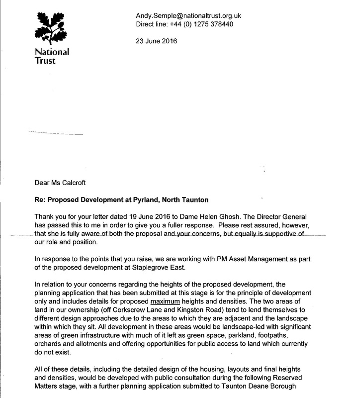
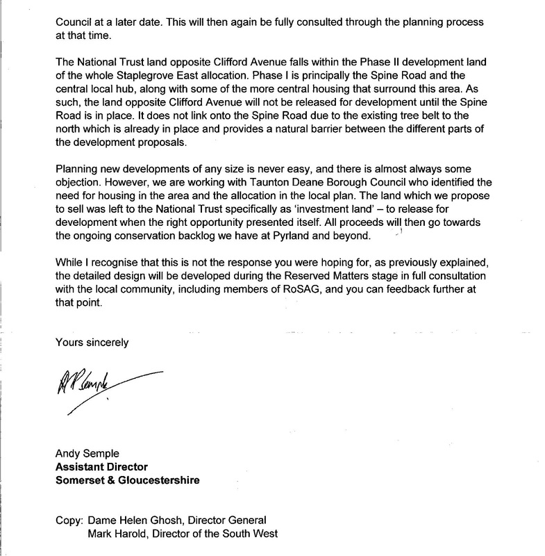
Thursday 23rd June 2016
Response from the National Trust to RoSAG's letter of 19th June
TDBC full council met yesterday evening and voted to adopt the Site Allocations and Development Management Plan (SADMP) This plan approves in principle the building of development in designated areas of Taunton. One of these areas is Staplegrove so will shape the way the planning application is considered in the New Year. It does however set out a clear set of conditions that both developer and council must abide by. Clearly this will be of great assistance to those who wish to challenge the building of more houses in North Taunton where the appropriate infrastructure will not be forthcoming in the first instance. Some of these policies are listed below. You can use these to justify your challenges when making your representation on the planning application website. Short cuts to both applications can be found on this site under "Further Information"
Policy A3: Cycle network
New development should not conflict with, and where relevant should provide for:
A. On and off-road cycleways as shown on the Proposals Map;
B. Traffic calming, traffic management and junction re-design to benefit cyclists;
C. Convenient and secure cycle parking facilities;
D. Provision of lighting on paths within, and where appropriate, between urban
areas to enable cycling after dark
E. Implementation of cycle schemes identified in the County Council's Future
Transport Plan.
Justification:
1.5.7 There are good opportunities to develop a network of new and improved cycle paths,particularly in Taunton but also to some extent in Wellington. On average, around 6% of journeys to work in Taunton Deane are currently made by bike, rising to 10% in Comeytrowe.
Levels of cycling in Taunton are some of the highest of any non-university town, but are still relatively low by the standards of many countries on the Continent. There is a need for significant investment in the provision of new cycle facilities and the maintenance of existing ones.
Policy A5: Accessibility of development
Residential development should be within walking distance of, or should have
access by public transport to, employment, convenience and comparison shopping, primary and secondary education, primary and secondary health care, leisure and other essential facilities.
All major non-residential development should be accessible within walking distance or by public transport to a majority of its potential users.
Provision should also be made for cycling between residential development and
non-residential facilities, or between a non-residential development and its
catchment area, where these lie within 5km of the development.
Maximum acceptable travel time (minutes)
For public transport, includes waiting time and walking times at each end of the
journey
Maximum acceptable walking distances (i.e. not 'crow fly' distances)
Residential development in Taunton and Wellington
LEAP 400m NEAP 1000m
Bus stop 400m Playing fields 1000m
Primary school 600m Health centre 1000m
Local shops 800m Secondary school 1500m
Policy ENV1: Protection of trees, woodland, orchards and hedgerows
Development which would harm trees, woodlands, orchards, historic parklands
and hedgerows of value to the area's landscape, character or wildlife will not be
permitted. Where the loss is unavoidable, the works (or development) should be
timed to avoid disturbance to species that are protected by law. Adequate provision must be made to compensate for this loss.
The proper management of this resource for nature conservation purposes will
be sought.
Justification:
1.7.1 The Framework emphasises that planning policies should aim to conserve and
enhance biodiversity. In line with the Framework, the Council considers it important to protect trees and hedgerows through planning policy as they make a vitally important contribution to both the landscape and biodiversity of the Deane while also enhancing its attraction as a place to live and visit.
1.7.2 The Core Strategy Policy CP8 provides a high level, strategic policy on protecting
trees and woodland in the Borough but does not go into sufficient detail on specific woodland policy.
1.7.3 The Borough Council will generally protect trees, woodlands, orchards, historic
parklands and hedgerows, particularly broadleaf species and those located in AONBs, and places open to public view. Hedgerows are a particularly important part of the pastorallandscape. Their loss is potentially harmful to the rural character of villages and lanes.
1.7.4 Only where trees, woodlands, orchards, historic parklands and hedgerows are not
considered to be of significant value, (in landscape, amenity, and wildlife terms) will
development likely to harm them be permitted. In those circumstances, developers will be required to provide adequate tree or hedgerow cover, as appropriate, to compensate for their loss. The management of such tree and hedgerow cover will be sought by planning obligations or Condition.
Policy D2: Approach routes to Taunton and Wellington
Development which would harm the visual qualities of routes into and out of
Taunton and Wellington will not be permitted.
Justification:
1.8.2 To maintain the attractive character of Taunton Deane, it is important to safeguard
the landscape setting and prevent unsightly or inappropriate development along approach routes into the Borough's towns, such as main roads and the main line railway. Examples in Taunton include South Road, Honiton Road and Trull Road from the south, Toneway and
Priorswood Road from the east, and Wellington Road and Staplegrove Road from the west. Kingston Road from the North (AM11)
In Wellington, examples include Milverton Road to the north, Taunton Road to the east and Exeter Road to the west.
1.8.3 Roadside advertising, additional highway signs, and design features such as traffic
roundabouts, have tended to proliferate and have caused main roads such as the A38 and A358 to become increasingly cluttered and unsightly. This is unfortunate as it is often these roads that provide visitors to Taunton Deane with their initial impression of the quality of the area. Visual impact therefore needs to be given greater weight in future decisions affecting planning and highway development.
Policy D8: Safety
The design of new developments shall incorporate measures to reduce the
likelihood of crime which are compatible with the need to create an attractive and
sustainable layout. This should include the following elements:
A. Maximising the number of neighbouring properties with entrances on street
elevations;
B. Locating public spaces, circulatory routes and car parking areas where they
are visible from within the maximum number of properties;
C. Minimising the possibility of direct access from public areas to the rear gardens of dwellings;
D. Ensuring that the layout of buildings, landscaping and lighting avoids the
creation of hidden or dark areas; and
E. Incorporating a mix of land uses which encourages activity throughout the day, where this is consistent with accessibility and residential amenity.
Policy D9: A co-ordinated approach to development and highway planning
A co-ordinated approach shall be adopted to the design of development and its
associated highways.
This should include:
A. Providing for safe walking and cycling routes;
B. Promoting an inclusive environment that recognises the needs of people of
all ages and abilities, including the need for social interaction;
C. Reflecting and supporting pedestrian desire lines in networks and detailed
designs;
D. Creating networks of streets that provide permeability and connectivity to
main destinations and a choice of routes;
E. Developing street character types with reference to both the place and
movement functions of each street; and
F. Designing to keep vehicle speeds at or below 20 mph on residential streets
unless there are overriding reasons for accepting higher speeds.
Where appropriate, the Council will seek a flexible approach to street layouts and
the use of locally distinctive, durable and maintainable materials, street furniture
and soft landscaping, including trees.
Policy SB1: Settlement Boundaries
In order to maintain the quality of the rural environment and ensure a sustainable
approach to development, proposals outside of the boundaries of settlements
identified in Core Strategy policy SP1 will be treated as being within open
countryside and assessed against Core Strategy policies CP1, CP8 and DM2
unless:
A. It accords with a specific development plan policy or proposal; or
B. Is necessary to meet a requirement of environmental or other legislation; and
In all cases, is designed and sited to minimise landscape and other impacts.
Justification:
2.1.1 The Framework recognises the importance of protecting and enhancing the natural environment. This also assists in meeting other core principles such as shaping patterns of development to reduce the need to travel, reducing pollution and CO2 emissions.
2.1.2 This is reflected in the Core Strategy through policies SP1 (Sustainable Development Locations) and DM2 (Development in the countryside) in particular which seek to apply strict control over development in the countryside to contribute towards meeting the wider aims of sustainability. The designation of settlement limits or boundaries provide clarity for the application of these policies.
2.1.3 Settlement boundaries assist in protecting the integrity of the countryside, providing a compact form to settlements, preventing sprawl and sporadic development and reducing visual impact on the countryside. Away from defined centres they also assist in reducing the consequences of unsustainable development. Policy SB1 provides further clarity to policies in the Core Strategy since, for example, it is necessary to seek to ensure that even where development may appear to constitute permitted development the Council can seek to minimise impacts through the prior approval notification system in order to limit undesirable development in non-sustainable locations.
Policy TAU2: Staplegrove
Within the area identified on the Proposals Map at Staplegrove, new
neighbourhoods will be delivered. A comprehensive and coordinated approach
to development will be required. Any planning application will need to be
accompanied by a masterplan and phasing strategy with associate infrastructure,
prepared by the developers in conjunction with the Borough Council and other
stakeholders. The masterplan and phasing strategy should include:
A new mixed-use local centre at the intersection of radial and orbital routes
adjacent to Kingston Road, comprising a convenience store (A1) of up to 500
m2 (gross); 500 m2 of other convenience retailing (A1), financial/professional
services (A2), restaurants and cafes (A3); at least one public house (A4),
take-away (Class A5) and a community hall building (comprising of main hall,
storage, kitchen, toilets) and associated parking, together with 0.25ha of land
for a place of worship. Residential or office uses should be provided on upper
floors;
A 2.5ha site for a 14-class, 2-form intake primary school with pre-school
facilities;
An extension of the existing Green Wedge on either side of Mill Lease Stream,
between Corkscrew Lane and the open countryside north of the existing 132kV
power lines;
Good cycle connections to existing cycle routes, in particular towards the
town centre via Gipsy Lane, Clifford Avenue/The Uppers, Bindon Road, and
along the route of the Northern Distributor Road;
Provision of direct and safe walking routes to access existing bus services
on the A358 and Kingston Road, and allowance for future provision of new
local bus services within the development;
Saturday 27th August 2016
RoSAG attended a community consultation on the 4th August held by Ptarmigan Land along with representatives from Staplegrove and Kingston St Mary Parish Councils and WARG the minutes of which are published below.
Community Consultation Meeting
Ptarmigan Land and PM Asset Management
Staplegrove, North Taunton
4th August 2016
Attendees:
Chris Rix (ROSAG)
Jackie Calcroft (ROSAG)
David Lausen (Resident)
Ray Stokes (KSM Parish Council)
Michael Clark (Staplegrove Parish Council)
Rod Williams (WARG)
For Staplegrove West:
Craig Neilson (Ptarmigan Land)
Joseph Hayes (Ptarmigan Land)
Chris Wilson (Origin 3)
Jane Fuller (Origin 3)
James Darrell (iTansport)
Michael O’Neill (Peter Brett)
Melanie Chiswell Brooks (Rockpool PR)
For Staplegrove East:
James Turner (PM Asset Management)
Tom Selway (Cadence PR)
1) Planning Update
Jane Fuller gave an update on the planning application and explained that consultation is ongoing and that technical issues are still being discussed. Somerset County Council (SCC) are in the process of carrying out a transport audit and no date has been set for a Planning Committee.
Craig Neilson introduced the agenda and offered a visual slide presentation to assist with the process of addressing the key issues for discussion.
2) Highways
James Darrell explained that using the Silk Mills Roundabout to manage additional traffic had been proposed originally but has since been ruled out because it would be too large and not have sufficient capacity. It is already over capacity and adding a fourth arm will make it worse. He went on to explain how the current proposals for a staggered junction will provide more capacity and safe pedestrian and cycle crossings. SCC are carrying out an audit of the proposals.
There was discussion regarding the phasing of traffic lights in Taunton and how the current system is not thought to be working. James Darrell explained that all the traffic lights related to the proposals would be linked together to facilitate good traffic flow and that the system was designed to manage traffic with the spine road in place and the reduction of traffic using Corkscrew Land and Manor Road.
Chris Rix questioned whether the proposed arrangement was related to a land ownership issue.
Craig Neilson confirmed it was unrelated to land ownership and explained that the new junction would be in place at the start of the development and will be secured as part of the S106 agreement.
Michael Clark asked if HGV movements from the slaughterhouse had been considered within the modelling and James Darrell confirmed they had.
Rod Williams asked when the additional junction modelling required by SCC will be completed. James Darrell confirmed that a transport assessment “addendum” is going to be submitted as a result of SCC’s audit over the month or so. A Statement of Common Ground is also going to be submitted to ensure agreement between SCC, TDBC and the developers in relation to highways.
Michael Clark asked what the timing is for start on site. Craig Neilson explained it depends on if and when planning permission is granted but it is likely to be 2018 at the earliest with approximately 6 months for the Silk Mills access to be built.
James Darrell explained that originally SCC had requested a roundabout on Kingston Road. However SCC has now agreed to reconsider a new signalised junction on Kingston Road instead of a roundabout. Designs for this will be submitted to SCC.
Ray Stokes and Chris Rix raised concerns about traffic moving up and down Kingston Road which is increasingly busy and the road is very narrow in places. They said this issue should really be dealt with via a northern outer distributor road but acknowledged that this is beyond the remit of Ptarmigan’s and PM Asset management’s control. They said the new junction is part of the solution but not all of the solution to traffic on a narrow, busy road.
James Turner explained that TDBC had asked that the eastern masterplan made provision for a future access for a northern distributor road which is shown on the plans. This is as much as PMAM can do in so far as delivering this distributor road.
Craig Neilson explained how a construction environmental management plan (CEMP) will be used to manage access to the development site and that consultees could feed into this when more details are available. Craig confirmed that construction traffic for the spine road would not be able to use the drop down road on to Corkscrew Lane and would instead be restricted to the construction vehicles of the houses in Phase 1A only. The CEMP will contain a prescribed route for this traffic, which would be via the Kingston Road end of Corkscrew Lane and not via Manor Road. A revised phase1a junction arrangement has been submitted to SCC for review which would prevent all vehicles from turning left into or right out of the access. It would therefore ensure that no traffic from the phase 1 access, construction related or not, would route through Staplegrove village.
3) Spine Road
Michael Clark expressed concern over the number of houses that could be built and occupied before the spine road is complete and how this would put severe strain on the road network, coupled with the additional construction traffic accessing the site. He reiterated the need for an outer ring road so that traffic could get to the motorway as well as the centre of town.
James Darrell and James Turner made the point that traffic using Manor Road and Corkscrew lane will be reduced by more than 60% once the spine road is in place so whilst there may be some short term “pain” over a period of up to 2 or 3 years, the overall gain in the long term will be a significant reduction in traffic and that if no development were to take place, the traffic congestion in the area would be far worse than it is with the development. The early highway works to the junction at Silk Mills will accommodate the extra traffic generated by the development until the spine road is in place.
Craig Neilson informed the meeting that the proposed alignment of the spine road has been changed from the preferred southern alignment to the northern alignment in direct response to community feedback during the public consultation last summer. The finer details of the alignment can still be considered at the Reserved Matters planning application stage when people will be consulted again on the proposals.
Chris Wilson explained how the Spine Road has been designed to echo the characteristics of a Somerset village with green corridors going off to the rural land to the north. It will work with its environment rather than appear to be a “harsh dividing line”. It will have Toucan crossings only and no traffic lights. There will be visitor parking bays dotted along it.
There was discussion regarding the “function” of the spine road and the most appropriate speed limit should be. Chris Wilson explained that traffic would flow through freely up to 30mph without the restriction of traffic lights. It would provide a wider, safer route than Corkscrew Lane and Manor Road. There will be a Travel Plan with the development and new residents would initially be given a free annual bus pass.
James Darrell and Craig Neilson confirmed that a meeting had taken place with First Group and a new one-way bus loop service will be provided and be funded up front by the developers until it becomes viable and self-funding. This will be secured as part of the S.106 agreement.
Michael Clark asked what could be done to stop residents parking in visitor bays and Chris Wilson explained that the parking would be short stay and managed via traffic management and that provision should be adequate for what is a low density scheme but there can be no guarantees that residents won’t ever park in visitor bays as per any other location.
Chris Rix expressed concern that TDBC are likely to try to reduce the number of parking spaces to be provided in an attempt to force people to use public transport.
Craig Neilson explained how the Spine Road will cost in the region of £6m and that the objective has always been to deliver it as soon as possible in line with the feedback received during the public consultation. It will be funded entirely by the developers as it is not covered by CIL and there is no public funding to put towards it. Craig explained how the temporary access drop down road was essential to be able to provide access to the west of the site to deliver the Spine Road in phase one. This access will allow 200 houses to be built on the western side, the sale of which will help to fund
the construction of the spine road. Without this temporary access, the spine road would not be completed until the end of the development.
Rod Williams expressed concern that a 5 year period of temporary access was unlikely to command the confidence of residents because 5 years would not be perceived as temporary and there was a risk this could overrun.
Craig Neilson acknowledged this concern and explained that the 5 years was very much a “long stop” date which would be referred into the development’s S106 agreement. He very much thought however the spine road could be delivered before then but there was obviously no guarantee this would happen. Although he would like to reduce this period, it would prove controversial with the housebuilder who would be building the road in the future as they needed enough time to build and sell houses which would help fund the road in Phase 1. He accepted the provision of a temporary access road on to Corkscrew Lane was not ideal however it enabled the “next best thing” to building the spine road in advance of the housing which is not financially viable and therefore not deliverable..
James Darrell and Craig Neilson explained that traffic management measures are being discussed with SCC and TDBC that would limit the ability of construction traffic entering and leaving the site in this location. Craig confirmed that construction traffic would be marshalled and only construction vehicles for the 200 houses would use this access not traffic related to constructing the spine road itself.
Chris Rix suggested that holding bays could be used to assist with vehicles passing.
4) Cycling and Pedestrian Routes
James Darrell and Chris Wilson outlined the proposed cycling routes for the development and how these have been designed to marry with the existing cycle routes into Taunton Town Centre. The route has been designed following Sustrans guidance. However TDBC have a preference for cycle routes on the carriageway. According to sustrans guidance, with the amount of traffic using the road, an off-road cycle route is recommended. Furthermore SCC have said they won’t adopt a prioritised cycle route on the highway and prefer an off road route. The details of the cycle route can be agreed at the Reserved Matter stage so there remains flexibility.
5) Green Wedge
Chris Wilson explained the layout and scale of the green wedge using the presentation materials. He explained that the blurred boundaries follow the existing geographical lines and enable the edges of each housing development to “interact with” and be part of the green space. Michael Clark and Rod Williams want the green wedge to be wider. Chris Wilson explained that if it was wider it would not allow natural surveillance of the play areas and would be screened by a row of trees rather than blending with the front facing properties that would benefit from being integrated with the countryside.
6) Water Management
Michael O’Neill outlined the proposals for managing surface water run-off on the development. He explained that run off rates are required to be significantly reduced from the levels they are now by using strategically placed attenuation ponds in the lowest areas of the site. Therefore in terms of
flood risk there will be a better system for management in a flood event that there is now. There was some discussion around how these work and the likely water levels within the ponds.
Rod Williams asked where any additional water would go if there is an extreme storm or rainfall and the attenuation ponds are full. Michael O’Neill noted that the attenuation ponds are very robustly designed (for the 1 in 100 year plus 30% allowance for climate change storm event) and a tried and trusted way of attenuating run-off. Overland flow routes will need to be defined and detailed as part of a condition on the Outline permission. It was acknowledged however that the attenuation ponds provide betterment when compared to existing conditions for very extreme events.
7) Landscaping, Density and Scale
Chris Wilson explained how an area of housing has been removed from the plan in response to public consultation. He discussed the design of the masterplan which provides an average of 40% green space across the development. There was discussion as to how the amount of green space was welcomed and better that that seen in other housing developments in Taunton. There was some concern expressed by Jackie Calcroft that some houses did not have any green borders. Chris Wilson explained that the detailed layout of the housing would be consulted on during the next stage of the planning process and there would be an opportunity to discuss it further.
Chris Wilson explained the principal of houses fronting on to the spine road to improve legibility and to enable landmark buildings to improve the experience of travelling along the road. This design is in keeping with the local character.
Rod Williams requested that the green buffers were doubled in width to increase the size of the wildlife corridors. Craig Neilson explained that they are already wide enough to properly function as attractive wildlife corridors and have been designed in consultation with the County Ecologist and Natural England who welcome them. Chris Wilson said the overall buffers amount to 11 Hectares of new planting and had been agreed with TDBC Officers.
Craig Neilson explained how the green space could be managed. It could either be managed by TDBC, the parish council or by a private management company funded by a service charge from the new houses. The latter of those options was the preferred option.
Craig Neilson explained how discussions are in progress with Western Power Distribution regarding the undergrounding of pylons on the site. At the moment the preferred option is to bury the cables underneath the northern perimeter buffer.
8) Key issues
The residents groups and Parish Councils outlined the following issues as remaining concerns although acknowledged it might not be possible to reach an agreement on all of them.:
a) The drop down temporary access road
b) The level of traffic on Kingston Road and the approaches to and from the junction
c) The overall scale of the development
d) The size and alignment of the green wedge
e) The way the development will interact with existing transport infrastructure in Taunton
f) Concern that there is as lack of public infrastructure to support the development and that new developments are a short term fix for Councils lack of resources
g) Concern that the development will not sell as they will not be enough demand and it will be left as a half built site
Finally, Rod Williams thanked the team from Ptarmigan Land and PM Asset Management for the time taken to prepare the presentation for the meeting on behalf of the group.
Thursday 23rd June 2016
Response from the National Trust to RoSAG's letter of 19th June
Monday 20th June 2016
RoSAG has sent the following letter to the National Trust.
Dear Dame Helen,
Re: New Town Scheme Between Taunton & Quantocks AONB
The Residents of Staplegrove Action Group [RoSAG] represents some 200 local people, the vast percentage of whom enjoy visiting National Trust homes and supporting an organisation that was about preserving the best in buildings and the landscape.
Recently, the actions of the National Trust locally have caused great consternation by joining forces with two promoters and putting National Trust land at Pyrland, near Staplegrove into two schemes. The two schemes are Staplegrove (West) and Staplegrove (East) and have planning numbers 34/16/0007 and 34/16/0014.
In total the two schemes combined propose around 1628 houses. A few years ago a much smaller number of houses [ originally 500 and up to 1500 maximum if ever needed] was put forward. Site promoters prepared a Masterplan for our Council, who like many other local authorities face financial cuts. Along with the allure of money from New Homes Bonus our council jumped at the opportunity to propose building on prime agricultural land which is habitat to an abundance of wildlife and also provides a green gateway between Pyrland Hall and the Quantocks [ the first AONB in England]
Putting what amounts to a new town between Staplegrove and the Quantocks is the height of irresponsibility. Not only would it completely change the landscape, but the infrastructure is inadequate and the new estates would be the wrong side of the motorway. The M5 serves as the link to Bristol and Exeter where most employment for local people is found.
Since the schemes first got publicity last year the promoters have made misleading statement after misleading statement. For example when challenged by the local paper (Somerset Gazette) on the houses being the gateway to the Quantock hills, Mr Turner for PM Asset Management told the paper (May 19 2016) -
“The homes will be mostly bungalows, so there will still be visibility to the Quantocks”.
In reality the plans clearly show the vast majority of new house to be between 2 and 3 storey with the topography of the land rising from the existing village of Staplegrove.
How can the National Trust allow this nonsense?
Prior to submission of any planning applications, the local Council passed a resolution stating they were unable to support any access from the proposed new development onto Corkscrew Lane / Manor Road as it is already over capacity. Corkscrew Lane as it’s name suggests is a narrow winding lane with many blind corners, no footpaths and traffic calming further down. .However, the promoters’ application details an access for some 155 houses to be built on National Trust land..This is the sole route in and out of this more exclusive cul-de-sac. All other houses access onto a central spine road within the development. Local residents trust that this decision, which will affect their quality of life, is solely down to the promoters and not a condition of sale imposed by the National Trust.
Frankly, I am very disappointed that the National Trust can join forces with people who grossly mislead local residents. I would be very grateful if you could look into what is happening, as it is seems so out of keeping with the values which I, and many others, thought the trust expounded.
I look forward to your response which will hopefully restore members’ confidence in the National Trust’s stated values.
Yours sincerely,
Jackie Calcroft
Jackie Calcroft
Pp RoSAG [ Residents of Staplegrove Action Group]
Sunday 19th June 2016
Continuing the Campaign
A " drop-in " workshop was held on Saturday June 18th at Staplegrove Village Hall
to advise on what further responses should be made to the planning application.
Saturday 30th April 2016
Reply to John Williams' letter of 28th April
April 30th
Dear Cllr Williams
Thank you for your detailed response to my earlier e-mail.
The link forwarded to the information re The New Homes Bonus [NHB] has been particularly helpful to help us gain a clear understanding of the Council’s situation. We were not aware of the Government’s intention [ subject to the outcome of their consultation] to reduce the “ payment per home rate” of NHB should a planning application within the Local Plan go to appeal. We are aware of the austerity cuts in Central Funding and appreciate the constraints these place on Local Authorities.
With regard to your figures relating to employment we concur that The Deane is the only authority with net in-commuting for work[ 5,713 net inflow ]. However, there appears to be no information to substantiate that this is not down to personal choice rather than an indicator of a need for more local housing.
Our understanding of the recent NOMIS figures for economically active population, which differ to those The Council quotes are: Jan 06 to Dec 06 54,900 and Jan 15 to Dec 15 57,200. An increase of 4.2%.
I appreciate The Council may feel between a rock and a hard place re NHB! You quote a figure of £16.6 million as being the envisaged NHB from current and proposed planned developments.
The Borough’s current Infrastructure Delivery Plan [IDP] is estimated as requiring £281.3 million! [schedule of costs page 63 7.1].
The government’s proposal is to not only reduce the NHB “rate “ in case of an application going to appeal but also cites the requirement for Local Authorities [ page 13 3.16 ]to keep their Local Plans up to date or be liable for a penalty. In 3.24 reasons for refusal of an application are cited as not necessarily demonstrating an unwillingness to support growth but due to “technical issues such as the adequacy of highways access”.
The new proposals do not come into effect until 2017 so it is understandable that there must be a temptation to try to beat this deadline wherever possible. However, this could be perceived as short-sighted and may prove counterproductive in the long run.
The fact that the whole of the required infrastructure cannot be funded through the NHB] and also that the Core Strategy needs reviewing could present an ideal opportunity for The Council to “ think outside the box” and be prepared to put any further developments on hold whilst reviewing what is best for Taunton. Yes, The council would receive less in NHB than expected but it would have a strong case which would be backed by facts relating to infrastructure requirements and also whole heartedly by electors . The Council would no longer need all of the infrastructure currently identified in the IDP to accommodate the many proposed new developments . I am confident that Taunton residents would support The Council in challenging the Government in case of an appeal and that The Council has more than sufficient evidence to demonstrate validity for amendment of it’s Local Plan.
I appreciate RoSAG’s opinion is probably very radical. But we like yourselves are keen to see and enjoy a vibrant County Town and not one which is like a “well known mint”. Everything is around the outside but nothing in the centre.
Thank you once again for taking the time to send RoSAG a detailed response .
I trust you will see this letter as constructive and would welcome your further thoughts.
Many thanks
Jackie Calcroft
Pp RoSAG
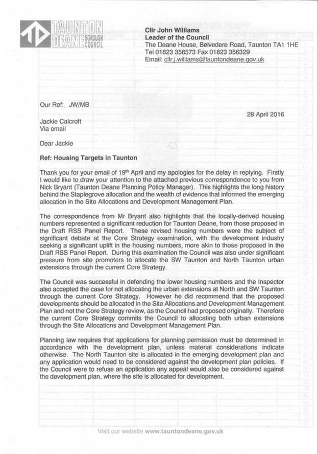
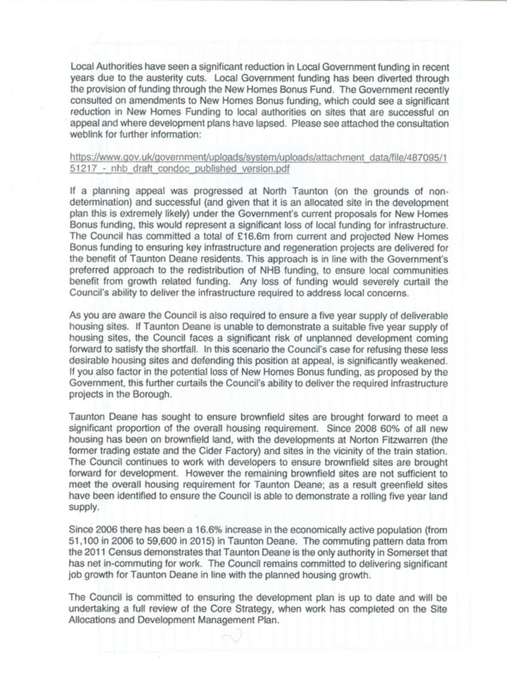
Friday 29th April 2016
Response from Cllr John Williams to RoSAG's email of 17th April

Sunday 17th April 2016
RoSAG has sent the following letter to Cllr John Williams leader of Taunton Deane Borough Council.
We are seeking to clarify the exact position regarding the alleged need for 17,000 new homes in the Borough. Local employment is on the decline, national housing targets were abandoned and decision-taking devolved to a local level.
Dear Cllr Williams,
I refer to the Council's frequent suggestions over the past 18 months that current housing targets [17.000 up until 2028 within the Core Strategy and subsequent SADMP ] are constrained by central government dictum. The said targets are also quoted as being employment led.
An increase in employment in the Borough as we know has regrettably but unsurprisingly not materialized. Employment figures continue to decline. Neither yourself nor your policy officer, Gill Littlewood dispute that employment trends have not gone as TDBC anticipated. In the adopted Core Strategy Cllr Mark Edwards states "We have therefore developed the Core Strategy with new jobs at its heart so that we can ensure that there is sufficient growth in employment to warrant the growth in housing"
In the residents' guide to Council Tax 2012 -2013 you state " -------the Core Strategy - placing great emphasis on employment leading development. This means that jobs as well as housing must be provided....."
The Core Strategy states that "Central to the Core Strategy are ambitious proposals for regeneration and growth for Taunton".
Whilst ambition is admirable it must also be recognised that it may not always be achievable thus requiring original proposals revisited and amended accordingly.
It appears that there is no legal obligation from Central Government on the Borough to build " 17,000" new homes by 2028. TDBC housing figures seem to have been determined by the Council from work undertaken by Fordhams and Roger Tym in the Spring of 2011. This was some 6+ months after the coalition government announced it's decision to revoke national house building targets for local authorities.
There has been frequent mention of penalties if the Borough does not achieve its target of 17,000 new homes by 2028. We ask for clarity as to what form such penalties take, by whom they are set and to whom they would be due.
As you will be aware RoSAG is not opposed to new housing per se in Taunton Deane. In addition we fully appreciate that a requirement for a 5 year land supply is stipulated by central government.
Our concerns are around the sustainability of Taunton and the integration of new development based on infrastructure , and in particular with reference to highways . A review of current housing needs should be carried out in advance of any further planning decisions being made to ensure that the Borough's Local Plan remains fit for purpose.
I quote from a letter received by a RoSAG member earlier this month from the Minister for Housing and Planning's office :
"Local Authorities interpret legislation, national policy and guidance according to local circumstances and are responsible for Local Plan preparation and local decision-taking. The Government does not set national housing targets or require councils to provide more houses than are needed. It asks councils to identify and plan to meet the objectively assessed needs of their communities based on robust evidence as far as is consistent with national policy as a whole.
Policy is also clear that councils need to ensure that there is sufficient infrastructure available to accommodate proposals brought forward in their Local Plan........................The Framework also makes clear that land of the lowest environmental and amenity value -including so-called brownfield land - should be used as a priority."
RoSAG firmly believes that the Council needs a thorough re-evaluation of it's Local Plan with particular emphasis on employment figures, already designated brownfield land and infrastucture.
We note the Local Government Association's Planning Advisory Service information in relation to SHLAAs
"The SHLAA is a technical assessment which will tell you what land is available, suitable and likely to be economically viable in your local authority area and which has the potential to be developed. It is technical evidence which will tell you about supply: it does not give the ‘go ahead' for development on sites identified, will not guarantee planning permission if an application comes forward and feeds into rather than replaces decision making processes such as development of your planning strategy (i.e. the Local Plan) and development management. "
Any further planning decisions should be deferred to allow time for a thorough review into " needs" to avoid the Borough finding itself in a situation where Taunton Deane becomes full of sites of half completed housing schemes and inadequate infrastructure . Once an application is given approval the Council loses control. I draw your attention to Summerfield Homes' site near Taunton Academy where a planning application was granted in 2013 for 99 affordable homes. The projection in the 2015 SHLAA [ Strategic Housing Land Availability Assessment] now shows a reduction to an eventual total of 52 dwellings [with 9 so far completed] . At the recent SADMP examination, we were lead to believe that a reduction to almost half the number of the original proposal is due to a difficulty in selling these much needed homes as identified in the Local Plan.
Thank you. I look forward to your reply
Kind regards
Jackie Calcroft
Pp RoSAG
Residents of Staplegrove Action Group
April 2016
The Government Inspector's Final Hearings Examinations for the SADMP [ Site Allocation Development Management Plan] were scheduled for Wednesday 30th March - Fri April 1st. This was a follow on to the meetings held in early December 2015.
RoSAG attended some of these hearings together with representatives from Staplegrove Parish Council and WARG. All parties put forward their case and the inspector will consider these before making his decision. We will post an update on that decision when it comes through.
Friday 26th February 2016
Summary of RoSAG Meeting 25th Feb 2016
The meeting was attended by well over 85 people. There was a good mix of representation. The majority attending were from RoSAG , and were joined by WARG members, Kingston St Mary PC , Staplegrove PC and other local residents including Meadow Sweet at Cross Keys, Hope Corner Lane, District Cllr Nick Townsend and County Cllr Danny Wedderkopp.
The summary below includes initial observations from RoSAG plus those from others present along with contributions from the 2 cllrs present. The points summarised are intended to serve as a guide to enable individual residents to make their own informed representations. They are not in a hierarchy.
Apologies for the length of this summary but so many helpful observations were made by so many and we have tried to include all!
Although RoSAG, WARG and the individual Parish Councils will each be making separate representations it is vital that every resident who is able seizes this opportunity to have their voice heard. Numbers do count! Residents owe it to Staplegrove and its future residents to try to get the best deal.
- TDBC’s website “latest summary” dated 18th February in the final paragraph states “------representations will be considered on both applications only if both numbers are included which is not possible until the second application is received”
- concerns that the application for the eastern side had not yet been submitted Cllr Bowrah’s [ chairman of planning cttee] reply to those who contacted him was that he and the vice chairman had raised the matter with planning officers on Mon 22nd and would get back when more was known
- RoSAG had not received a reply from John Burton, TDBC planning officer handling this application seeking explanation in lay people’s terms of particular planning jargon
- K St M Parish Council had received a reply from PMAM [ site promoters east] regarding the timescale of a planning application for the eastern side of the site. This stated that an application was due “within the next 2 weeks. It is the intention that the 2 planning applications will be treated as a whole”
- WARG had received a reply to their query “ The application for the eastern side is about to be submitted imminently so will be a few weeks behind the western side” ------“The reason for 2 separate applications ----- ---PMAM promoting eastern side---- and Ptarmigan ----western----. As such 2 separate applications are being submitted-----------the 2 promoters and their technical teams have worked closely together to prepare a joint Framework Masterplan and to ensure that both east and west proposal work together and complement each other”
- Cllr Nick Townsend explained that in planning applications there is a statutory 21 day deadline. He said that up until the planning cttee deadline representations would still be accepted [ and all are circulated to relevant cllrs] but the sooner the planning dept had indications of the concerns the more opportunity they had to consider /address these before the planning cttee met.
It is anticipated that both applications [ east and west] will be considered by the planning cttee on the same date
- : Do get in your initial, individual representation before March 17. There are no restrictions as to how many times /letters be sent in per household. Additions can be sent in right up until the planning cttee date
- SCC Cllr Danny Wedderkopp explained how because of his supporting RoSAG and S/grove PC’s concerns re deadline and the fact that only the west of the site application had been submitted, he had been told he has “fettered his discretion” and no longer able to sit on planning cttee for this application. He is now able to publicly support residents in their opposition and will be writing to Gazette / speaking at cttee.
- INITIAL OBSERVATIONS and FURTHER COMMENTS
- Despite TDB Councillors stating last December that they could not support a drop down road on to Corkscrew Lane the site promoters have still included it in their application. TDB Cllrs need to be reminded of their decision and urged to adhere to it on grounds of Highway Safety. This road already has traffic calming aimed at reducing traffic use and is totally unsuitable for additional traffic.
- Building the spine road in its entirety before any building commences is still the optimum. Otherwise, at the very least, a route to the first phase of building should be from one end of the spine road. A route for construction traffic will need to be via Kingston Rd or Staplegrove Rd and this should be constructed to also accommodate the new residents from the first 250 houses rather than them using a drop down road onto Corkscrew Lane
- There are many internal roads leading onto the spine road long with proposed buses on this route plus the proposal to have some house frontages onto it. The spine road therefore will not be as free flowing as suggested and will in fact encourage traffic to use of Manor Rd /Corkscrew Lane.
- Concerns were raised re parking bays / emergency vehicles / buses on a spine road of only 6.75m width impeding traffic flow and rendering it unfit for purpose as a possible future Northern Outer Distributor Road [ an aspiration of SCC and TDBC]
- Concerns were raised re the proposed access of some driveways directly onto the spine road and their risk to cyclists / pedestrians
- Concerns were raised re the fact that cycle paths were not continuous, thus necessitating cyclists to cross the spine road to complete a journey!,
- The spine road’s points of access onto both Staplegrove and Kingston Roads need a total re-think re safety, traffic flow including the total number of traffic lights proposed
- Cllr Nick Townsend encourages individuals to contact SCC direct re their concerns as well as via planning application comments
- It is accepted that this site is earmarked for development. What we can do is to try shape it for the better
- Cllr Danny Wedderkopp, whilst accepting highways is an important issue, advised individuals also need to focus on other matters of infrastructure [ eg secondary educ – SCC education dept say only The Academy has space for 200 pupils which may be taken up by Comeytrowe development]/ density / flooding /building heights/ proximity to AONB
- The density of housing and proposed 2 storey buildings in the west is not in keeping with the existing village and local properties
- The lack of green space in the west needs addressing
- Planning statement page 12 section 3.3 states. “ The proposal is for a new landscape-led community which aims to respond positively and sensitively to surrounding areas to the south and to the open countryside to the north in order to --------and to soften the long distance views”
- There is concern that residents should insist on a suitable Construction Environmental Management Plan [CEMP} now rather than await next stage of detailed planning application. [A CEMP details restrictions on the builders eg work hours/ construction traffic hours etc]
- Cllr Nick Townsend said that the promoters have reports submitted by professionals and the planning cttee can only consider those unless other challenges / assertions from resident are backed by equally well qualified experts. This was challenged by one resident who stated that the council also had the option if representations did raise concerns re reports that in addition to expecting residents to fund expert witnesses the Local Council had 2 other options --- to request further information from the developers / promoters or to fund their own independent expert witnesses. Cllr Towsend confirmed this.
- Parts of the documentation refer to a possible total of 1628 houses!
- Flooding is a real concern. Residents quoted areas of real concern and said that some may have photo evidence locally of last floods [ 2012?] These will be useful to refer to and offer as evidence if needed. Also RoSAG may be able to use such information at planning cttee stage so please advise us if you have such docs
- Concern was expressed over the misinformation of facts in the applicants’ documentation. They quote only 2 accidents on Manor Road / Corkscrew Lane in the last 5 years. IF YOU HAVE ANY RECOLLECTION OF ACCIDENTS PLEASE LET US KNOW TIME / DATE / SITE / TYPE. Thank you.
- Similarly although there is an ecological plan the data does not appear to be documented regarding wildlife and their habitats. There seems to be no mention re known bats' flight path to the rear of Lawn Rod and Hillhead cottages
- There is concern re short sightedness and the permanent loss of agricultural land
- The proposal is for 1500 houses – is this a done deal or can we influence that?
- Is the highways risk assessment data now out of date and need reviewing?
- Similarly are original projections for the number of houses based on employment figures out-dated and in need of review?
WRITING YOUR LETTER OF REPRESENTATION
Representations can be made on the form enclosed with the letter to local residents from TDBC if you received one. They can also be made via e-mail or a letter handed in or posted to TDBC
We deliberately do not offer a template as letters written from a personal perspective will have most impact!
Please note the following:
- Letters need to contain your name, address and a date
- Letters need to contain the name of the planning officer responsible ------Mr J Burton and also the application number 34/16/0007
- Any comments re loss of view or loss of value to your property will not be considered
- Will you be overlooked, overshadowed or suffer loss of privacy?
- Is there a visual effect upon the landscape eg loss of trees and hedgerows?
- Is a public footpath affected?
- Will there be an increase in noise and disturbance eg from the coming and going of extra traffic?
- Is there adequate parking ?
- Is the development dangerous for road users and pedestrians?
“ Googling “ letters of opposition to a planning application will bring up a plethora of links. The CPRE website and hampdenfields action group offer good advice on writing letters.
In addition it is worth raising concerns regarding wider infrastructure problems --- traffic and in particular highways safety / pressure on health, education and social services / impact on wildlife etc
In Law persons have the following rights:
“A person has the right to a peaceful enjoyment of all their possessions which includes the home and other land”
“A person has the substantive right to respect for their private and family life”
Do consider this application with regard to these rights especially if you border the proposed site
Further considerations
- Will the proposed development have an overbearing effect or a dominating impact on you as an adjoining property and /or the neighbourhood as a whole?
- What effect has the topography of this site in particular the impact of the height of new houses on current properties / rest of village as a whole?
- Will the proposed development by reason of its size, depth , width, height and massing have an unacceptably adverse effect on the amenities of properties immediately adjacent to the site and surrounding area by reason of overlooking, loss of privacy and a visually overbearing impact?
NEXT STEPS
- Tell neighbours and other friends across Taunton of the possible impact this development may have on them
- Remind people that this application is just for half of the proposed development713 houses is not the entire development in North Taunton
- Staplegrove PC has called a meeting w/b Feb 29 for reps from WARG / RoSAG / Kingston St Mary PC to consider a response to this application
- Staplegrove PC meet 5pm on Wednesday March 23rd
- Staplegrove Village Hall is booked for a RoSAG mtg on Friday April 1st at 7pm. It is anticipated the application for the east will then be in and we will need to convene to update
- Local “area groups” need to meet to discuss aspects specific to their situation in addition to the impact of the generic issues of this proposed development eg Sandene and Hill head Cottages / Lawn road/ Manor road and Manor Orchard / Langford Lane/ Rectory Rd / The Manor etc PLEASE TAKE THE INITIATIVE TO SET UP SUCH GROUPS AND APPROACH YOUR NEIGHBOURS TO DISCUSS ISSUES WHICH ARE PARTICULARLY RELEVANT TO YOU
DO REMEMBER
Please do keep abreast of the individual representations which will regularly be appearing on the TDBC planning website. Remember easy access is via www.rosag.org under Further Information. These letters may provide you with inspiration which is relevant to your own situation. Also, do remember there is no limit to the amount of letters each household may send in – so if you wish to add anything to an earlier submission that is fine. You can keep on adding right up to the date of the planning cttee.
This summary is only in relation to the western part of The North Taunton Development!!! Comments on the eastern site will need to be responded to separately.
Keep an eye out for the planning application for the eastern part of the site
Thank you all. Please do not assume that everyone else will be writing in and you don’t need to! Every letter will count!
Thursday 18th February 2016
TDBC have received a planning application from Ptarmigan Staplegrove Ltd for 713 dwellings
For more information click here
Thursday 28th January 2016
TDBC gives outline planning approval for 2000 homes in Comeytrowe & Trull.
The following report was compiled by a RoSAG member who attended the planning meeting on the 27th Jan.
As many of you might know by now, On Wednesday January 27th, Taunton Deane Plans Committee gave outline planning approval for up to 2,000 homes in Comeytrowe & Trull. While this result was disappointing, it was not unexpected as considerable pressure - with warnings of dire financial penalties - was put onto councillors to approve.
The evening meeting began with officers and advisors assuring the Plans Committee that the scheme ticked all the boxes and to warn that if the outline plans were not approved Taunton could lose millions in government funding (from New Homes Bonus) and probably would have to pay a ' six figure sum in compensation to the developers'.
After an hour, 30 Comeytrowe and Trull residents plus two from close-by parishes spoke for around three minutes each. It soon became apparent that the parish councils and residents had done an immense amount of work and were able to make objections and raise concerns on planning grounds. Time and again residents were able to show the inaccuracies, omissions and nonsense in the developers' proposals, and to show the incompetence of Somerset County Council's Highways department. (It was incredible to hear repeatedly that the effect on Wellington Road, Honiton Road and Taunton in general were "not the developers' concern"). Most speakers concentrated on their concerns about traffic, flooding, green spaces and the environment. However, many also commented on the developers riding roughshod over everyone with a lack of real consultation and the ignoring of the emerging Community Neighbourhood Plan. These points were taken up by two local councillors who also addressed the Committee.
Despite the result, residents can be proud of what they have achieved. They have been able to make the developers make some changes, and they have certainly given notice that they will not now go away. Negotiations between TDBC officers and the developers will hopefully lead to better outcomes than if they had done little research. What contribution this Comeytrowe and Trull development makes to gridlocked Taunton only time will tell!
So what does this mean for Staplegrove, as we are also facing a 'Masterplan' written by the developers for a development of around 1,500 homes, which "equates to the addition of a small town"? We have made considerable progress in pointing out various areas of concern and officers and councillors are now aware - and have admitted - that parts of the promotors' / developers' 'Masterplan' are flawed. Maybe this has lead to the delay in the submission of the outline planning application? There is considerable expertise in our community for us to make objections and raise concerns on planning grounds and to insist that the appropriate investment is made in infrastrucure. The stakes are high and we certainly will not be giving the promotors / developers an easy ride!
Other points of interest from the Comeytrowe / Trull meeting -
* Atlas - the government advisory organisation for large scale housing schemes - admitted that extra funds would be needed for infrastructure in addition to those that would be raised by the CIL (Community Infrastructure Levy) and S106s from the developers.
* Somerset County Council's Highways department must have some plans for future road improvements / ring roads, which they should have given to TDBC planners, so that intended routes can be protected from being built on. If not, why not?
* Nick Townsend (TDBCCouncillor) is on the Plans Committee and he voted for the Comeytrowe / Trull scheme. Danny Wedderkopp (SCC Councillor), who is also on the committee, was absent.
Saturday 16th January 2016
The preliminary findings relating to the SADMP hearing on 1st & 2nd December 2015 have now been published and are available to view on the TDBC website
https://www.tauntondeane.gov.uk/planning-policy/site-allocations-and-development-management-plan/
We are expecting further hearings some time in the future to discuss Infrastructure and other issues.
